History
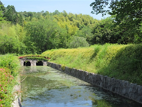
Tatsugoyama Castle was built by the Ōtsuka Clan, though it was not clear when. However, from 1602 Tozawa Masamori maintained a fortification at the foot of the hill which was known as Matsuokajō. In 1622 the Tozawa were forced to relocate to Shinjō-han in Dewa. Matsuoka was reconstituted as part of Mito-han. Nakayama Nobumasa was given the castle in 1646. The Nakayama Clan acted as castellans until 1707 when they abandoned the castle for another location. They however returned in 1803 when Nakayama Nobutaka re-established the castle. It was at this time that the castle town leading up to the citadel was developed, remains of which are present throughout the neighbourhood to this day. Tatsugoyama Castle never had any towers: the honmaru was located on the hillside with the ninomaru, which contained the lord’s residence, at its foot. The adjacent sannomaru contained administrative facilities, as well as kitchens and stores. The lord’s retainers lived in homes located in both the third and second baileys. The castle town developed leading up to the castle’s entrance, marked by a moat which is still present today.
Visit Notes
ven though there a no stone ruins, only dug moats and piled earth, the surrounding neighbourhood has retained its character from the late Edo period. A broad street paved with brick stretches out from the castle entrance bordered by a traditional wallscape, including a pair of thatched roof gatehouses. There are many old houses and structures in the castle town, the grandest of which is a farmer’s manor dating to 1777.
| Castle Profile | |
|---|---|
| English Name | Tatsugoyama Castle |
| Japanese Name | 龍子山城 |
| Alternate Names | Matsuokajō |
| Founder | Ōtsuka Clan |
| Year Founded | Before 1602 |
| Castle Type | Hilltop |
| Castle Condition | Ruins only |
| Designations | Local Historic Site |
| Historical Period | Pre Edo Period |
| Features | water moats |
| Visitor Information | |
| Access | Takahagi Station on the Jōban Line, 40 minute walk or bus |
| Visitor Information | free, 24/7 |
| Time Required | 60 mins |
| Location | Takahagi, Ibaraki Prefecture |
| Coordinates | 36° 44' 19.14" N, 140° 42' 18.11" E |
|
|
|
| Admin | |
| Added to Jcastle | 2016 |
| Contributor | ART |
| Admin Year Visited | Viewer Contributed |
| Friends of JCastle | |
| Jōkaku Hōrōki | |
| Kojōdan | |
| Kojō Seisuiki | |


Enable comment auto-refresher
ARTShogun
Permalink |